When the power goes out and the cell towers go quiet, every ham asks the same question: which repeater do I reach for?
Not the closest one. Not the one with the clever callsign. The one most likely to still be on the air. The one sitting on a mountaintop with batteries, run by a club that actually shows up, and written into the county’s emergency plan.
So I built a tool to find out. It’s part of a project I call RadioBuilder, and this is its first public output. For each of 8 regions, from the Bay Area to the Eastern Sierra, it pulls repeater listings, checks FCC license records, looks up the true elevation of each site with the USGS, and layers in research on who runs the machine, when their nets meet, and whether a county ARES, RACES or CERT plan names it. Then it scores everything two ways:
- Infrastructure: Will the machine survive? Site height, backup power, emergency affiliations, on-air status.
- Community: Who’s behind it? A club license, an active club, regular nets, a place in a county plan.
Start with the top pick in each region, then tap a region to see every contender. Open “Why this score” on any card to see exactly how the points add up, and where the research came from.
One honest caveat before you dig in. This is a starting point, not gospel. Backup power is what owners report, and as the Mt Oso note below shows, batteries don’t always last. Before you count on a machine, key up, check in on its net, and get to know the folks who keep it running. That’s how this hobby works best anyway.
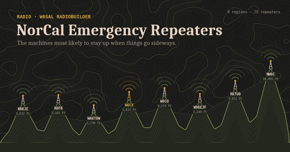
The repeaters most likely to stay up and stay useful when things go sideways, ranked for 8 regions from the Bay Area to the Eastern Sierra. The infrastructure score covers site height, backup power, emergency use and status. The community score shows who is behind the machine: a club, regular nets, and a place in a county emergency plan.
Top pick in each region
| Region | Call | Output | Site | Infra | Comm | Who runs it |
|---|
Contenders by region
Infrastructure score
| Site 3,000+ / 2,000+ / 1,000+ / 500+ ft | 30 / 24 / 16 / 8 |
| No elevation, but a named peak or ridge | 12 |
| Emergency power (owner reported) | 25 |
| ARES 10, RACES 10, SKYWARN 3 (cap 20) | 20 |
| On air (status unknown 5) | 15 |
| Open to all (closed 0) | 10 |
| 2m band | 5 |
| Hospital or EOC site | 5 |
| Record updated in 2 yrs (5 yrs: 2) | 5 |
Community score
| Club license (FCC) or known club | 15 |
| Active club, recent activity | 5 |
| Regularly scheduled net | 5 |
| In a county ARES / RACES / ACS / CERT plan | 5 |
| Backup power documented by the owner | 5 |
Linked networks are not scored. Each callsign appears once. Every machine it runs in the region is stacked on the card from 2m to 1.25m to 70cm, then other bands; the highlighted row is the one that earned the score. 1.25m and other bands are shown but not scored.
Read these with care
- Emergency power is what owners report to RepeaterBook. Mt Oso (WD6EJF) batteries ran down in a 2-day PG&E shutoff in 2025.
- Elevation is measured only where the location is exact, or borrowed from another repeater at the same named site within 40 km. City-center locations are left blank.
- Club research came from web search results and RadioReference listings. Low-confidence rows deserve a check before you rely on them.
- Only 2m and 70cm machines that are not off air and not private are ranked.
Spot something wrong or out of date? Let me know. The whole point is to keep this accurate for the next time we need it.
73, Sal, W6SAL